Parks for all Californians
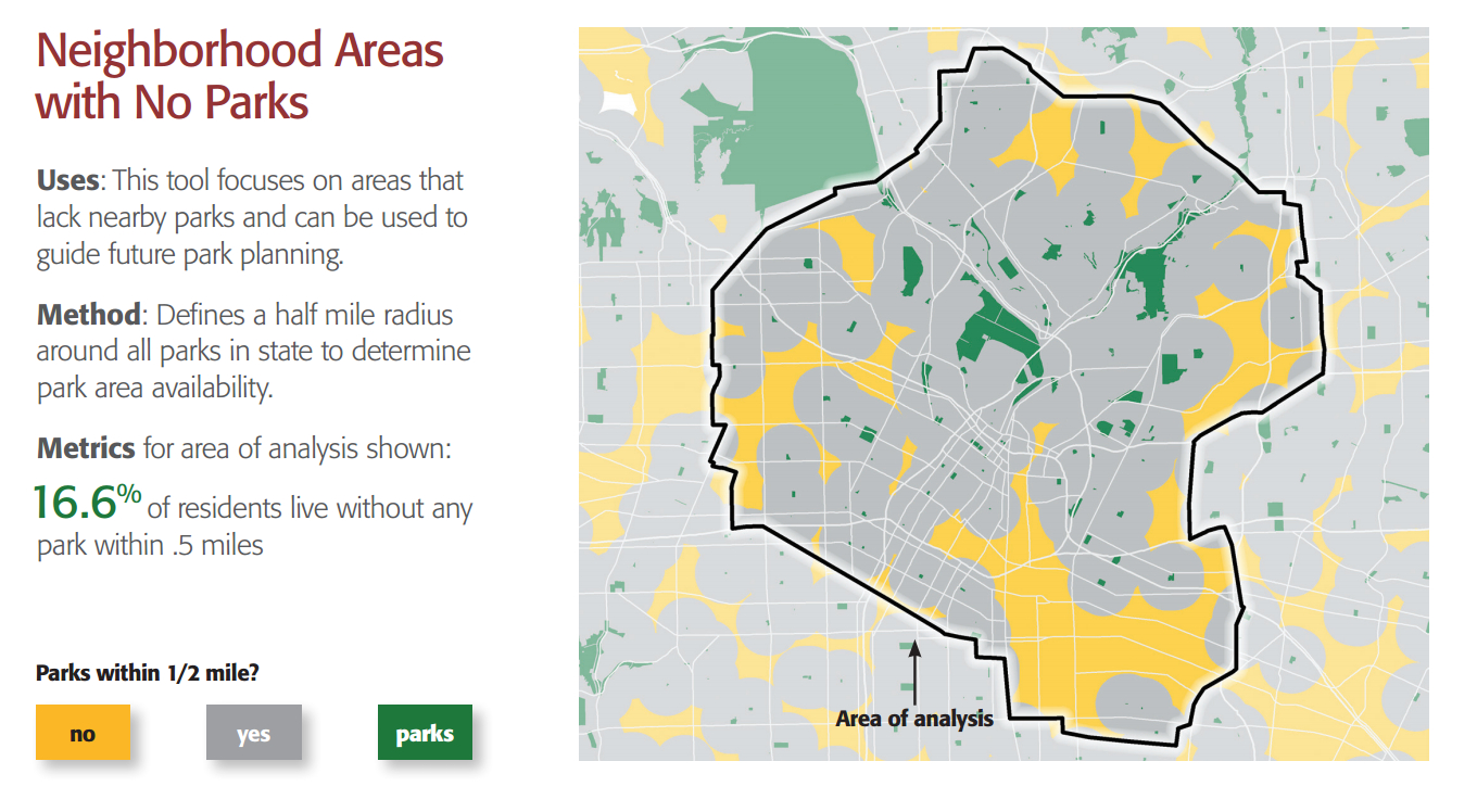
Where do Californians need more parks? That’s a crucial question for the California Department of Parks and Recreation’s Office of Grants and Local Services (OGALS), which administers grants to local parks agencies using federal and state funds. For its most recent strategic plan, the OGALS team took an innovative approach to ensure funds were distributed equitably.
The Park Access tool measures where Californians need more parks, and is driven by park data from CPAD and demographics from the American Community Survey. With CPAD’s inventory of 14,000 parks, OGALS could confidently assess how well California communities were being served by parks.
Try the Tool